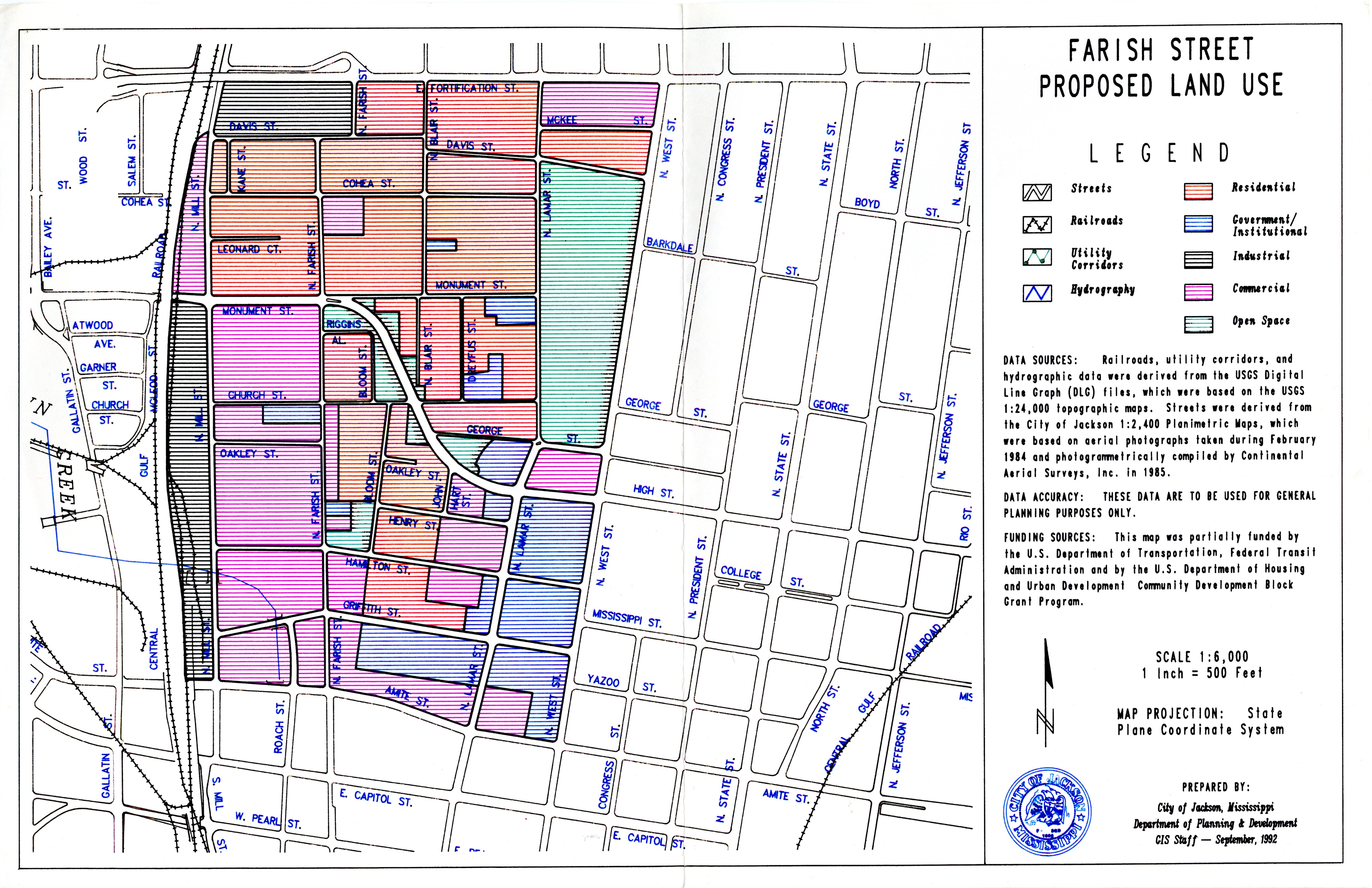
Farish Street Existing Land Use Map
Item
-
Title
-
Farish Street Existing Land Use Map
-
Date
-
1992-09
-
Creator
-
City of Jackson, Mississippi Department of Planning & Development GIS Staff
-
Description
-
A map of the Farish Street Historic District with markers for different land uses: streets, railroads, utility corridors, hydrography, residential, government/institutional, industrial, commercial, and open space.
-
Primary Subject
-
1900-1999 | Urban Life | Business
-
Additional Subject
-
Architecture
-
Location
-
Farish Street Historic District | Jackson | Mississippi
-
Type
-
Map
-
Medium
-
Paper
-
Measurements
-
17 in x 11 in
-
Format
-
JPEG
-
HBCU Identifier
-
mwchcac.oh.2022.fsp.photo3
-
HCAC Identifier
-
HCAC.JSU.0015
-
Rights
-
All rights held by the Margaret Walker Center. For permission to publish, distribute, or use this image for any other purpose, please contact Margaret Walker Center, Jackson State University, 601-979-3935 Attn: Center Director
-
Contributing Institution
-
Jackson State University
-
Source
-
Supplementary photograph collection with The Farish Street Project Oral History Collection
-
Collection
-
The Farish Street Project Oral History Collection